No products in the cart.

$ 0.00
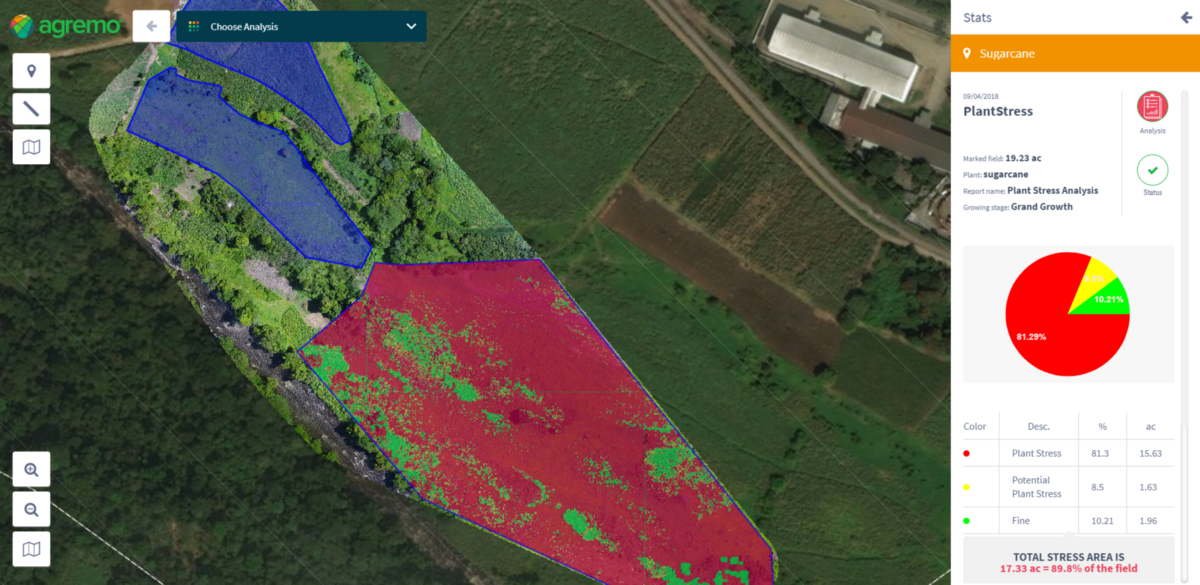
Map makers, topographers and even archaeologists need aerial surveys to fully evaluate some of their projects. In the past, companies had to shell out for costly helicopter and airline flights to give them the aerial perspective they needed. However, drone operators can provide these same great aerial views with lower overhead costs. Drones can also fly low and slow, which helps them capture better images of a site than a traditional aircraft.

